After my last post the weather turned grim, meaning I had 5 days in a row of going into the airport,
Airline Prep
planning and cancelling which was very frustrating. However, the last 6 days have been excellent and I've done a lot of flying in that time.
Me doing a solo nav with Mt Pirongia in the back ground
I've started the navigation phase of my flying which is a new challenge. It takes a fair bit of time to plan a nav from scratch. You need to choose where you're going, how far it is, what track to fly, what ground features to look out for, then work out the wind at the altitude you're going to be flying and determine your heading and ground speed from that. You need to check the weather to make sure it's good enough to go and you're not going to get caught out. You then of course need to do the mass and balance and performance sheets along with a fuel log. I get to the airport about 2.5 to 3 hours before a nav flight to make sure I'm prepared.
Flight Log
Fuel Log
Mass & balance
Mass & balance - C of G
Performance
Performance
Chart
There are techniques used to make sure you navigate accurately, such as event cycle features, which is when you look for certain ground features and determine how far away from them you are and how far away you should be. Say you were meant to be 1 mile north of a particular town after 5 minutes but were actually 1 mile south of the town, you would realise you are 2 miles off track and therefore, using the standard correction angle of 30 degrees, fly for 2 minutes to regain the track then assess why you were off track. This must be done regularly do make sure you don't stray far from your designated track. You must keep track of your time so if you reach a planned point a minute late then you must amend your ETA accordingly. You must also do regular cruise checks to make sure the compass and DI are aligned, you're on the right radio frequency, the fuel is what it should be, the engine is running ok, you know where you are etc. This is all becomes a lot harder if it's a bit bumpy and you're trying to fly an accurate heading and altitude.
6 AM walk round
Low level cloud in the valley
Kawhia Habour
West Coast
The first two nav flights are with the instructor thankfully and you get a chance to get used to the techniques. The first flight seemed so stressful because there seemed to be so much going on and it always takes some time to get used to new things.
The second nav was a lot better because I knew what to expect so could visualise what I was going to do more easily than before. We also practised some hazard avoidance, lost procedure and diversion techniques. So we flew from point A to point B normally, practising the normal nav technique then shortly after passing over head B, diverted around some high terrain then tried to get back on track. I didn't know where we were and there was very little ground features to go off. We then orbited over a small town and looked closely at the features in the area and from that determined where we were.
Kawhia Harbour
We then diverted to a different location than planned which means drawing a rough line to the point and estimating a heading, distance and time. The same techniques are then applied and if all goes well, you arrive at your diversion point on time.
Nav 3 & 4 are solo where you fly the routes you've done with the instructor backwards. So you kind of know where you're going and what you should be looking for. My first solo nav was really scary because I've never gone that far on my own before and was thinking about all the possible things that could go wrong. And for a 10 minute period after take off I thought I'd lost my radio's because all I could hear was white noise! After a few nervous minutes though it just came back to normal and all was well with the world again. I reached all my points on time and landed safely back at Hamilton which was a huge relief.
Lake Taupo
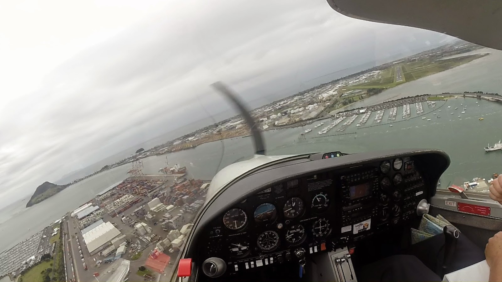
Finals turn for Tauanga
Nav 4 was probably the best flight I've had so far! It was a beautiful route to the west coast, inland to Lake Taupo and back up to Hamilton. It was an early morning flight and the weather was as clear and calm as I've ever seen. It totally justified exactly why I am doing this course and made me think there's nothing else I'd rather be doing.
East coast - Matakana Island
Lake Rotorua
Finals for Rotorua
Nav 5 is another dual nav where you do a bit of flying under the hood and do a touch and go at two airfields, both in control zones so it gets quite busy. It's important to be prepared and always be ahead of the aircraft. We went to Rotorua and Tauranga then did some lost and diversion practice. It was so much fun but hard work. I'm meant to be doing that route in reverse on my own next so it should be interesting.
Kaimai ranges
I also did a couple of general handling lessons in between navs. For 4 days in a row I have been up at 4;30 or 5;30 am for two back to back flights, each one 1.5 to 2 hours so I'm very tired now but it's been great fun!
Waitoa
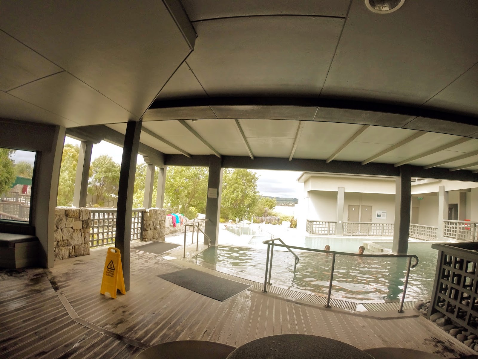
On my last day off a few of us went over to Rotorua to visit a thermal spa. It's right on the lake and the pools are naturally heated. 41 degrees Celsius they were! It was nice, we just sat and relaxed for a few hours being hot and wet.
Thermal spa
I've managed to get a couple of cricket training sessions in as well as a match, which we lost on the last ball sadly but it was a good game. I think A round of golf was squeezed in some how too.
So, a very busy few days it's been but I think it's fair to say I'm making the most of New Zealand.
At least you're keeping on. We highly appreciate how you realize that commitment to flight for a whole new batch of folks who may take a glance on your blog. Owning a plane for real should move things up to the next step, too. Kudos to you!


.jpeg)
.jpeg)
.jpeg)
.jpeg)
.jpeg)
.jpeg)
.jpeg)


.jpeg)
.jpeg)
.jpeg)
Great read. Thanks for sharing !
ReplyDeleteAt least you're keeping on. We highly appreciate how you realize that commitment to flight for a whole new batch of folks who may take a glance on your blog. Owning a plane for real should move things up to the next step, too. Kudos to you!
ReplyDeleteRaymond Curry @ Holstein Aviation